Tag Archives: Hell Hole Trail

Hell Hole and Barker Creek

My late October to early November trip into the Granite Chief included the Shanks Cove and Greyhorse trails, which I’d not been on this year, the Hell Hole trail and explorations around there, and a off-trail hike up the Rubicon River and then out Barker Creek to Barker Pass.

On my trip up to the area, I slept out near Truckee, and it was very, very cold, well below freezing, so I guess I can call summer over. After tea and breakfast to warm up, I headed into the wilderness at Alpine Meadows TH, thence to Whiskey Creek Camp. I explored around Five Lakes lake, the largest one, which is the only one with significant water late in the year, which I’d not done in years. I generally avoid this most popular destination for day hikers, but it was early and on a weekday, so I figured correctly there would be few people. It is a beautiful lake, the only really alpine looking lake in the Granite Chief.

Five Lakes main lake

From Whiskey Creek Camp I followed the Western States (Picayune Valley) trail to the junction with Shanks Cove trail, and thence up to the ridge where I camped for the night. It was much warmer up there than it had been in Truckee, though I was 650 meters higher, since cold air drains away from the ridges and towards the valleys. In the morning I walked out the Greyhorse trail to the trailhead, which is no longer marked by anything, then back to the ridge and down Shanks Cove trail to the Five Lakes Creek trail. The Shanks Cove and Greyhorse trails have not been maintained in a long while, and there are many trees down, most easy to bypass but a few not. The winter debris (which this year came mostly from high winds in the fall) is thick in many places. And brush is encroaching on the trail in many spots. On the plus side, there were small flows of water in some of the little creeks that I was sure would be dry in this dry year.

I camped near Diamond Crossing and spent time just watching the creek and seeking out the brightest fall color trees. Then down the Hell Hole trail. The two forks of Buckskin Creek were flowing a little, but Steamboat Creek was completely dry. I explored downstream, where I have found water in the past, and did not find any, but I didn’t check upstream. Steamboat is always one of the earliest creeks to dry. Down the the bottom, where there is a vague junction with the trail coming from the 4WD road at Greyhorse Creek, with the route up canyon parallel to Five Lakes Creek. I have found and maintained about half this trail, but the other half is still uncertain, just wandering through forests and finding vague traces of trail here and there.

I continued my exploration of trails and routes in the Hell Hole and Rubicon River area, trying to make sense of how they fit together. I made some progress. I walked out the official 14E02 Hell Hole Trail to the dam and across. It is not marked in any way at the trailhead, but if going in that way, one would park at the boat trailer parking lot, walk down the steps, across the dam, and to the beginning of the trail on the south side. The dam is not open to vehicles but there is a hiker gate. This trail is not much used, but is surprisingly pleasant given how close it is to the reservoir, and is decently maintained. At a point just above the Upper Hell Hole Campground, which gets very heavy use by boat-in campers when the reservoir is up and the weather nice, a connector trail goes down through the old upper campground and to the east end of the lower campground. Continuing on the main trail, it gets harder and harder to follow, but traces of it exist and seem to lead to the Rubicon River just where it narrows in its first canyon. From the eastern-most campsite, a route marked with rock ducks heads along the ridge, then down to a crossing of the Rubicon at what I call huckleberry camp (there are more red huckleberry bushes in this area than one would expect at this elevation), then back up onto the ridge between the Rubicon and Five Lakes Creek, connecting with the route from Five Lakes Creek end of the Hell Hole trail and the route that goes down to the Rubicon at the same canyon point as the possible trail. With a better understanding of how the trails and route fit together, I have updated my tracks on GaiaGPS.

Rubicon River

I then spent half a day trying to figure out where the McKinstry trail goes, but at this I failed completely. There are little fragments of trail along the Rubicon River, but they don’t seem to connect. I know that when I walked the McKinstry trail years ago, it was not that hard to follow though not maintained, but now I can’t even seem to find the place where it climbs up out of the Rubicon Canyon. So, that remains for another trip, and I still don’t know what the condition of the McKinstry trail is.

Leaving the trail finding project behind, I ventured out on a no-trail trip up the Rubicon River and then Barker Creek. The river canyon was dark and cold, probably never getting direct sunlight at this time of year, so I decided against continuing up canyon, which is beautiful, and only possible in low fall water. Instead I headed up Barker Creek, which is incredibly beautiful. There are here and there traces of a route marked by rock ducks, but it pretty much is just walking up the bottom of the canyon, walking around pools and jumping the small creek. The canyon eventually gets too rough to follow and I climbed out alongside the canyon to the more gentle terrain above. From there cross-country, and along some of the OHV trails (fortunately empty on this day), and then the PCT/TRT up to Barker Pass. And then down to Blackwood campground for the night, and out to catch the TART bus in the morning to Tahoe City.
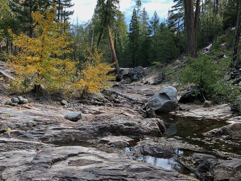
Barker Creek,cottonwoods

I bought some gloves from Alpenglow, which I had most unfortunately forgotten on this trip, and have only some heavy waterproof gloves at home, and spent the rest of the day just enjoying Tahoe City. The following morning to Truckee, and caught the Amtrak California Zephyr home to Sacramento.

This will be my last long backpack trip (nine days) and my last mountain backpack trip of the year, but I’ll continue shorter backpack trips in the Sierra foothills and the bay area throughout the winter and spring, until next summer backpack season in the Granite Chief.

Photos on Flick: https://www.flickr.com/photos/allisondan/albums/72157716780807318; Granite Chief collection on Flickr: https://www.flickr.com/photos/allisondan/collections/72157637640215275/.

more Hell Hole area trail work

My July 18-24 backpack was into the Hell Hole area of the wilderness, mostly for trail work.

I went in at Granite Chief trailhead in Squaw Valley, and up to the PCT. I camped along the ridge with a view west and particularly northwest, but there was a band of clouds in that direction and I did not see the comet. From there I headed south on the PCT, turned to Whiskey Creek Camp, and south along the Five Lakes Creek Trail. From Diamond Crossing I went down the Hell Hole Trail, doing some light trail work along the way, and down to the junction near the reservoir with what I call the Hell Hole Connector Trail, which goes to the road into lower Greyhorse Creek, and the McKinstry ‘trail’ route down from south of the Rubicon.

I manage to follow the Hell Hole Trail all of the time from Diamond Crossing to Steamboat Creek now, with the trail definition I’ve done, but I sometimes still lose the trail for a while from Steamboat Creek down to the bottom. The problem is that there have been many trails, many of them marked with rock ducks and cairns, so if I get off the main trail, I find other trails and it takes me a while to realize. Nevertheless, it is now much easier to find your way than it used to be. Someone has marked parts with orange flagging, and there was only one place the orange flagging was in the wrong place, and I removed it.

From the junction near the reservoir, I went upstream to where the ‘trail’ route crosses Five Lakes Creek, and camped near there. My time down in the canyon was split between exploring to find trails and doing trail work. I walked about half way out to dam along the trail 14E02. I had thought this trail did not exist, but it does, and it is actually in pretty good condition. From the Upper Hell Hole Campground, there is a clear trail to the upper campground area, and then a vague short trail connecting to this trail, and that is how I accessed it. Coming back, I followed it eastward. Though the trail becomes vague, and then mostly disappears when it drops into a forested flat, it does seem to go all the way to the Rubicon River, very near where a waterfall area forces the route from Five Lake Creek area up and over a bench. The official maps show this, more or less, though I did not really believe them. I also explored the many routes between the trail at Five Lakes Creek and the Rubicon River. There are several routes in places, only one in other places. Where the seemingly main route comes down to the Rubicon River, there is a campsite with a heart shaped rock wired to a tree, not far from a pond on the divide between the creek and river. Just upstream along the river is a thicket of huckleberries, which are rare in this area and at this elevation.

My main objective was to further locate and define the trail between the Hell Hole junction and Five Lakes Creek. I partly found the trail, though across the manzanita flat I could not really tell where the trail had been because the manzanita had grown so thick over the years. I cleared a new or old trail through the manzanita, so that there is now a visible trail for about half the distance. I also think that I have located the traces of trail to link together to complete the other half, but there will be at least one more trail work trip to make that visible. And, then, there is the whole question of the McKinstry Trail which crosses the river and climbs south to a road. I don’t know whether it exists anymore. I’ve heard various and conflicting information. That will probably have to wait for next year, as it will take this year to clear the trail to get to the Rubicon.

I have a GPS track for the section of the McKinstry Trail I’ve made visible, but it needs some editing, so is not posted the my GaiaGPS maps yet.

All of the creeks are now rock-hopable. Some of the smaller creeks and the ones which are seasonal every year have dried. Steamboat Creek was still flowing at the time of my trip, but was dropping, and I very much doubt that it still flows, at least at the trail crossing.

I went back out via the PCT and Five Lakes Trail, to catch the bus at River Ranch.

Trail conditions:

  • Granite Chief Trail: good condition, some brushy areas but no problems
  • PCT, Granite Chief Trail to Whiskey Creek Camp Trail: good condition with a few downed trees and a few brushy areas
  • Whiskey Creek Camp Trail: good condition, one downed tree
  • Five Lakes Creek Trail, Whiskey Creek Camp to Diamond Crossing: many downed trees so that it is becoming unpleasant and slow to walk; this trail has not been logged out in many years; severe tread erosion in may places
  • Hell Hole Trail, Diamond Crossing to junction with McKinstry Trail: hard to follow from Diamond Crossing down to Five Lakes Creek, easy to follow to Steamboat Creek, challenging to follow from Steamboat Creek to junction, but mostly visible and marked with rock ducks; many downed trees but with ways around or over all of them
  • McKinstry Trail: no longer a trail, but a route that can be followed with close attention to maps/GPS tracks and visible remnants and rock ducks; unknown condition past the crossing of the Rubicon River
  • PCT, Whiskey Creek Camp Trail to Squaw Saddle Trail: good condition, some brush
  • Squaw Saddle Trail: good condition
  • Five Lakes Creek Trail, to Alpine Meadows Trailhead: good condition

I’m off for a trip in the Mokelumne Wilderness, and then back to the Granite Chief for my next trip in September. For my readers and backpackers, enjoy your travels, and let me know of your experiences.

Photos on Flickr: https://www.flickr.com/photos/allisondan/albums/72157715387628207; Collection on Flickr: https://www.flickr.com/photos/allisondan/collections/72157637640215275/.
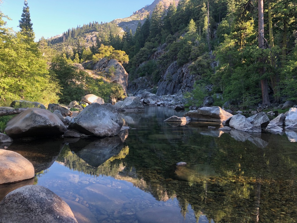
trail work

My trip July 2-9 was mostly into the Hell Hole Trail area. I went in at Alpine Meadows trailhead, down Five Lakes Creek, to Hell Hole Trail and McKinstry Trail, and then back out via Powderhorn Trail, north along the PCT, and out at Alpine Meadows ski area.

The Five Lakes Creek Trail is in gradually deteriorating condition, with more down trees added to the existing ones, and more issues with tread erosion. The Hell Hole Trail is in decent shape though there are downed trees that have now been there for years, and a few more are added every year. I have been working on defining the tread, so the trail is becoming somewhat easier to follow, though some sections still have a lot of winter debris accumulation. The trail from Diamond Crossing down disappears as it approaches Five Lakes Creek, due to thick willows and downfall, but it is not too hard to find a way through. The trail from there to below Steamboat Creek (which was still flowing well) is in decent condition, though it requires close attention to follow. There are a large number of oak trees down over the trail switchbacks about 2/3 of the way down the hill to the lower end of the trail, but you can bypass them by paying close attention.

I did some more work on what I’ll call the McKinstry Trail, from the junction at the bottom of the Hell Hole Trail, so it is now defined from the point near Five Lakes Creek crossing to about a third the distance back to the junction. But the 2/3 closer to the junction is very hard to find, and I have not yet identified what the best route is. I’m sure the original trail just headed across the forested flats, but the helicopter logging that left all the debris, and a weakened forest generating downfall, has completely obscured these sections. Eventually I’ll figure and and define the best route, but for now, one just has to head in the right directly and hope to pick up the trail again.

After crossing lower Five Lakes Creek, the route again is lost in the forested flats. It shows up again where it climbs up on the ridge separating Five Lakes Creek drainage from the Rubicon River, and is marked with rock ducks to where it comes back down to the river. I have not been past the crossing of the Rubicon in years, so the condition of the rest of the McKinstry Trail is unknown to me. There are also use trails that follow the ridge between the two drainages down towards the reservoir, but I haven’t been on those in years either.

Heading back out, I took the Powderhorn Trail, which has more downed trees but is not in bad condition, walked the road to Barker Pass, and headed back north on the PCT. The PCT is in good condition from Barker to the PCT/TRT junction. After all these years, it seems the the Tahoe Rim Trail Association has finally reached the desired state of good repair: no downed trees, no brushy sections, tread in good condition. Thank you! North of that junction there are a few downed trees, and some areas needing brushing (which apparently only I do, but I haven’t done in about three years). I intended to go out through Five Lakes back to the trailhead, but realized there were going to be hundreds of people on that trail, so I went out through the Alpine Meadows ski area, which is no shorter than the trail, but I only saw one person.

Rubicon River near McKinstry Trail

I’m just about to head back into the same area, to do a little more trail work and a little more exploring.

Photos on Flickr: https://www.flickr.com/photos/allisondan/albums/72157715140370061

Hell Hole part 2

As is not unusual, I forgot to complete my post on the final trip of the 2019 season. I only had two trips in 2019 because deep snow kept me out of the mountains until mid-July, so instead I backpacked parts of the Bay Area Ridge Trail. And was back at work in mid-August, with my long weekends otherwise occupied.

This was another trip into the Hell Hole Trail for maintenance and trail finding. I have tried many times over the years to create a single track for the Hell Hole Trail from Steamboat Creek down to the intersection with the McKinstry Trail, but failed. This time I finally succeeded, but it took two days of walking up and down, and some editing of the resulting GPS track when I got off track despite all my prior explorations. The trail is now available on GaiaGPS in my Granite Chief folder, labeled as ‘Granite Chief HellHoleTrail lower’. I spent some time working on the least obvious spots, but the trail is still hard to follow and I’d not be surprised if others lost the trail. The gully section is marked with cairns (rock piles of three or more large rocks), but unfortunately so are many of the less than desirable routes. In 2020 I hope go back and define the trail better. I cleared and defined the trail from Steamboat Creek to where it first comes into the gully, which stays higher on the slope than many of the other routes. I think this may actually be a bear trail rather than the official route, but it works better than the others, so it is the one I’ve used. I’ve changed the track color to yellow, which means a route rather than a trail, since much of it is still hard to follow. This trail is not safe for horses. Most of it is, but there are three cruxes where the trail has slipped away and the tread is too precarious. Though, long ago, this was definitely a horse trail. I’ve wondered if the gully was similar when the horse trail was still usable, or if it developed afterwards and is why it is no longer horse-usable. Don’t know.

I also worked the trail section from the jeep road to Grayhorse Creek to the junction with the lower trail (above) and the route that heads up Five Lakes Creek and sort of connects to the McKinstry Trail. This 4WD, high clearance most of the way until it starts dropping into Grayhorse Creek, take off from FR 24 near the Hell Hole Guard Station (not in use). The part from the trailhead, which is unmarked, to Grayhorse Creek was well overgrown in many places, but is now followable. If you are coming down the jeep road, the trail starts at a little grassy bench just before the last very steep road down to the reservoir. Early in the season, Grayhorse Creek roars down its gorge and may be impossible to cross at the trail. I did some work on the remainder from the creek to the trail junction, but it is not as clear and may be hard to follow in places. If the reservoir is down, you can also follow the shoreline from the base of the 4WD road and informal camping area, to the old mining road, and thence up to the trail crossing. The junction with the Hell Hole Trail lower is not obvious, but is on top of a ridge just beyond a bouldery dry creek. This section is available in GaiaGPS as ‘Granite Chief HellHole connector’, orange on the map. Note that this is the same Grayhorse Creek that the Grayhorse Trail follows, but the two sections are about four miles from each other.

Grayhorse Creek at trail crossing

I’ve done a little bit of work on the trail section east of the junction, but can pretty much guarantee you won’t be able to follow it. In fact, there are several vague routes, which don’t always connect with each other. It will be many days work to find, and then make obvious, that trail. Nevertheless, there are many wonderful things to be seen along lower Five Lakes Creek and the Rubicon River, so if you are adventurous, don’t let the lack of a trail keep you out. You might even run into the fragments of trail I have worked.

While doing trail work, I camped on the granite ridge which overlooks the Rubicon canyon, just south of Steamboat Creek. It is a great place to watch sunrises and sunsets, and the stars through the night. As I’ve stated elsewhere, Steamboat Creek is seasonal at the trail crossing, but it was still flowing for this trip. If it is dry at the crossing, either explore up or down the creek to find water, or just pick up water at Buckeye Creek on your way there. If you are coming up from the bottom, carry enough water to make Buckeye Creek in case Steamboat is dry. There are some small seeps in the gully, but I think they are seasonal as well.

sunset from camping spot

In my previous Hell Hole Trail post, I had noted an old trail sign and wondered if it marked the old Buckeye Trail (no longer a trail) junction, and yes, it does. I followed the trail for a half mile, and it is clear that it was at one time, long ago, constructed, though I don’t know whether it an be followed further. Another exploration for another trip!

Photos on Flickr: https://www.flickr.com/photos/allisondan/albums/72157710205332747

Trails on GaiaGPS: https://www.gaiagps.com/datasummary/folder/5b4e23c555d0dc5fd992f16948fb09de/

Hell Hole Trail

I spent the second half of my recent backpack trip working on the Hell Hole Trail, specifically the upper part between Diamond Crossing (junction with Five Lakes Creek Trail and Powderhorn Trail) and Steamboat Creek.

Over the last few years, there has been more and more down trees on the trail, but by far the worst part was a ways past Buckeye Creek where there is a tangle of down trees in an Incense Cedar forest. This had gotten so bad that the bears had stopped using it and made their own way, with trails above it and below it, and the trail itself had essentially disappeared. The issue with the bear trails is that, though they eventually reconnect, it is quite some distance before they do, and a hiker is likely to notice there is no people maintenance and no people marking, and figure they are ‘lost’. Happened to me twice, and once was quite a long detour. So, I spent some while finding the trail again, and defining it well enough that it can be followed. I only take light trail tools, including a folding Fiskars saw, so can’t do anything about most of the down trees, but most of them are easy to step over or climb over, so defining the trail well enough to follow, keeps hikers on track.

There is also a lot of winter debris (that is what I call the branch litter that covers the trail after the snow melts, though any wind storm contributes to the debris). This can also make the trail quite hard to follow, so in confusing spots, I cleared the debris, perhaps a quarter of the total. There are a number of leaning trees, young white firs mostly but other species as well, that make the trail hard to use, and I was able to cut many but not all of those.

The section from Diamond Crossing junction down to the crossing of Five Lake Creek is partly marked with small rock ducks. There is a defined trail in places, but trees keep falling on the trail at the lower end, and when I’ve made bypasses, trees have fallen on those as well. Coming from Diamond Crossing, if you just keep heading downhill along the drainage, you will hit Five Lake Creek close enough to the crossing. Going up hill, it is easier to lose the trail, but you will eventually hit either the Five Lakes Creek Trail or Powderhorn Trail, and get back on track.

So, the status is that anyone who has a careful eye out for the trail should be able to use the trail again. However, beyond Steamboat Creek, you are on your own. I have neither walked nor maintained any of the lower trail in the last two years, and even that was minimal.

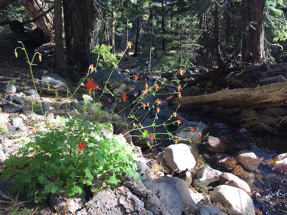
Crimson Columbine (Aquilegia) at Steamboat Creek

At the time of my trip, 2019-07-21/25, Five Lakes Creek was a calf-deep wade across a wide bar in the river. I always stay clear of the down tree tangle downstream, far more dangerous than anything in the creek. Both forks of Buckeye Creek were flowing, and I believe at least the eastern fork is year-round. Steamboat Creek was flowing well, however, it dries up at the trail crossing at some point during the summer, and I’m sure it will this summer. I have in other years found water upstream and downstream of the trail crossing, but there are no guarantees. If you are going, stock up on water at Buckeye Creek, as it is a long ways to Five Lakes Creek below, or the reservoir shoreline, if Steamboat is dry.

I followed the lower Hell Hole Trail a ways from the Steamboat Creek crossing. This section used to be obvious, but it is getting harder and harder to follow, and I lost it before getting to the gully. The bears have abandoned this trail, seeming to go above across the slope, but there may be other bear trails I did not find or notice. Coming up the gully, one apparent trail leads into a pretty valley between two ridges, but so far I’ve not found a route out of that valley and back to the main trail, so this may be a red herring. If the bears have their doubts, then I have my doubts, and I am not sure that the old trail alignment is the best route anymore. My next trip will be in part to determine what the best route is. I know that the bears are still going between lower Five Lakes Creek and middle Five Lakes Creek, but I don’t know what they have decided is the best route.

A little tidbit. Steamboat Creek is NOT where it is shown on the maps. The USGS map, and every map based on it, which is probably every map including GaiaGPS and the Forest Service base maps, has it to the east of its actual location. It is not that far off, only about 300 meters, but it is off.

GaiaGPS now offers the Forest Service base maps (USFS 2016 CalTopo), and it is interesting to see what the Forest Service shows for trail locations as opposed to other maps such as GaiaGPS, USGS, and Trails Illustrated. I am not sure which maps are available to which membership levels in GaiaGPS, so you will have to explore that on your own. GaiaGPS now offers scanned 1930 maps, and the trail locations definitely vary, however, these maps have much less accurate topography, at least in rough country such as the Granite Chief, so the trails may be less accurate as well.

I noticed a trail sign on the ground that I had not seen before, below. I’m wondering if it is at one of the original locations of the west leg of the Buckskin Trail, so I will explore that on the next trip. I know that there is a vague old trail leaving the Hell Hole Trail just past Steamboat Creek, which is at least one alignment of that old trail, but there may be more than one, and some maps indicate that the trail takes off east of Steamboat Creek. I enjoy looking for and locating old trails which have not been maintained in decades, but at the same time, I want to do trail work on existing trails so that they don’t meet the same fate!

Photos on Flickr (this includes the entire 10 day trip, not just the Hell Hole portion): https://www.flickr.com/photos/allisondan/albums/72157710021027427.

First trip, down Five Lakes Creek

For my first trip of the season, July 4-10, much later than recent years, I headed in at the Five Lakes trailhead and went down Five Lakes Creek. There were only snow patches on the trails, and they would be gone by now. There are a few trees down as far as Whiskey Creek Camp, and a moderate amount of winter debris, the branches that come down over the winter and can be throw off if one has the time. From Whiskey Creek Camp southward, there are more trees and more debris, with the biggest issue being young firs bent over the trail. More snow than usual at these middle elevations bent these trees.

From Diamond Crossing south to Steamboat Creek, there are a lot of trees down, and a lot of winter debris. In fact, this trail segment has become quite difficult to follow. When you leave the trail to go above or below a fallen tree, it is very challenging to see the trail and get back on it, being so covered with debris that it looks just like the rest of the forest floor. If this trail doesn’t receive some maintenance within a couple of years, it is done for. Bears provide a lot of the trail maintenance on these lesser-used trails, and there is evidence that the bears are starting to prefer other, easier routes over the old trail, and if so, that is the beginning of the end. 

All of the named creek crossings were wet ones. Some are probably rock jumps now, but some may still be wet. The snow melt has created tread erosion in a number of places. No surprise. When you combine an almost complete lack of water control structures on the trails with a wetter winter, erosion is the result. 

I spent two days doing maintenance on the lower third of the Powderhorn Trail. The doghair fir is pushing into the trail, so the hiker has to push through it. I cut those back, so the trail is in good condition, with a bypass around one down tree. However, another down tree that can be bypassed by hikers may well be a barrier for equestrians since it is on a steep side slope in a dense forest. The real issues on the Powderhorn are in the middle third section, where doghair fir and whitethorn brush have essentially closed the trail. Though the alder section below the postpile formation has been an issue in the past, I’m guessing that it is still passable. I did not have time to work on the middle third, so good luck if you go there. 

I met a Forest Service wilderness ranger, Nathaniel, on the Five Lakes trail. This is the first time in many years that the Granite Chief has had dedicated staff, so I’m looking forward to more attention being paid. 

The flower show is just developing, with pentstemons, mules ears,and a few others. 

I did not go north or south on the PCT, nor any of the other trails in the wilderness, so have nothing to report on them. As always, I welcome comments from others on trail conditions, creek crossings, and water sources. 

Photos on Flickr

Rubicon & Desolation 2014-08

Big Meadow

Big Meadow

I missed posting about a trip last summer, so here it is. I did not notice until I was catching up on posting photos to my Flickr site that I had an entire trip not yet labeled and uploaded. I must have been waiting until the photos were up before I wrote a post, and then forgot about both.

I went in at Alpine Meadows trailhead, walking up from the TART bus on the highway. There had been thunderstorms during the day, but nothing by the time I got in. There were footprints and a few people between the trailhead and Whiskey Creek Camp, but nothing and no one past there. I camped the first night at Big Meadow, always a favorite campsite.

Continue reading

Through the watersheds

Drummond’s Anemone, near Little Needle Peak

I had a great six day trip through the Granite Chief Wilderness, plus some additional country to the north. I went in at Alpine Meadows Trailhead, and out at Squaw Valley Trailhead, with at least 67 miles in between.

Since some people read this blog for trail conditions: Five Lakes Creek cannot be crossed anywhere downstream of the PCT trail crossing, except on logs. The Middle Fork of the American River cannot be crossed at the Picayune Valley trail crossing, but can on a log downstream. The Five Lakes Creek Trail is mostly clear of snow. Upper Grayhorse Trail, upper Picayune Valley Trail, and upper Granite Chief Trail are largely under snow, but the trails can be followed with attention.

Continue reading

Down in the Rubicon

ridge south of Little Needle Peak

Had another wonderful five day backpack in the Granite Chief last week. A lot of the trip was just re-visiting places I’d been before, some of them not in several years though.

As a new trip I went to Little Needle Lake which I’d heard other people mention but not been to. It is a shallow, alder and willow bordered lake in the volcanic rock below Little Needle Peak. It is a pretty setting, with soggy wet meadows surrounding the lake and a spectacular cliff above. The route is is a vague trail, and there are some seldom used campsites at the lake. To avoid the thick mosquitos at the lake, I camped to the north on a granite bench, where there were some really cool trees and a great view of the end of the day down the Middle Fork American River canyon. The next day I headed up onto the ridge and south, following the divide between Picayune Valley and Five Lake Creek, eventually reconnecting to the Picayune Valley trail a little east of where it climbs out of Picayune Valley. The ridge does not have a trail, but the going was pretty easy, with great views and a different perspective than I’ve gotten elsewhere.

Continue reading

Off-trail explorations 2009-07-16

Washington Lily

On a four day backpack from Barker Pass, I did quite a bit of exploring off trail and on old trails. The snow has really disappeared since I was last in the wilderness in June, with just patches on or close to the trail now. And of course there are a lot more flowers now, except on the ridgelines where the flowers were already great.

I explored Grouse Creek from the PCT down to the Five Lakes Trail. In the upper part I stayed as close to the creek as possible, but in the lower canyon it becomes too difficult to do so, and the bear trail led me out onto the ridge to the northwest, with great views back up Grouse Creek and up and down Five Lakes Creek. Washington lilies were poking up through the manzanita thickets on the ridge, and down along the ridge a number of dry rocky plants were blooming.

Continue reading