J3773 : Orangefield Baptist Church, Belfast
taken 14 years ago, 3 km from Belfast, Co Antrim, Northern Ireland
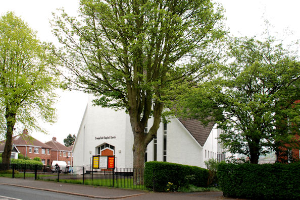
Orangefield Baptist Church, Belfast
The view from the North Road.
Orangefield Baptist church, Belfast
Orangefield Baptist church, at the corner of the Orangefield Road and the North Road seems to have been built in 1966/67. It has an ornamental false belfry.
![Creative Commons Licence [Some Rights Reserved]](https://s1.geograph.org.uk/img/somerights20.gif)
|
· Find out How to reuse this image ·
Share:
|
|||||
|
There is 1 post in a
discussion on J3773 (preview on the left) |
Suggest an update to this image | Contact the contributor | |||
Loading map... (JavaScript required)
- Grid Square
- J3773, 403 images (more nearby
 )
)
- Photographer
- Albert Bridge (find more nearby)
- Date Taken
- Tuesday, 4 May, 2010 (more nearby)
- Submitted
- Tuesday, 4 May, 2010
- Geographical Context
- Place (from Tags)
- Category
- Church (more nearby)
- Subject Location
-
Irish:
 J 372 736 [100m precision]
WGS84: 54:35.5419N 5:52.6444W - Camera Location
-
Irish: J 372 736
- View Direction
- EAST (about 90 degrees)
Other Tags
Image classification(about):
Geograph
This page has been viewed about 292 times.
View this location:
KML (Google Earth) ·
Google Maps ·
Bing Maps ·
Geograph Coverage Map ·
More Links for this image
·
Bing Maps ·
Geograph Coverage Map ·
More Links for this image